
Chapter 24 of 28 · Pearl Harbor: The Story of the Secret War by George Morgenstern
Maps
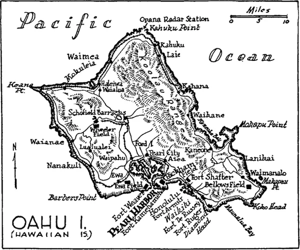
The island of Oahu, Territory of Hawaii, showing objectives of the Japanese attack, of December 7, 1941, which brought the United States into World War II. [This and succeeding maps were drawn by GARY SHEAHAN.]

Pearl Harbor, showing berthings of the Pacific Fleet when the Japanese attaked on December 7, 1941. Warships indicated in black, were sunk; those in black and white damaged but afloat.
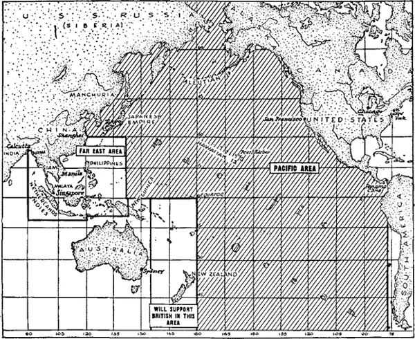
Under the Washington conference agreement, the United States was made solely responsible for the defense of a huge stretch of the Pacific Ocean (shaded area). American naval forces were to support British forces and operate under British strategic direction in the Southwest Pacific east of Australia. Britain was to exercise strategic direction in the Far East area.
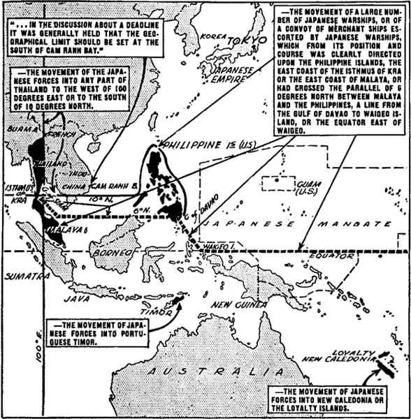
This map depicts various “deadlines” established by agreement of the United States, Britain, and Holland to contain Japanese expansion. Any movement of Japanese forces beyond these prescribed limits would compel joint resistance by the associated powers. These plans for joint action were approved by President Roosevelt months before Pearl Harbor, “except officially.”
Pearl Harbor: The Story of the Secret War
Read the whole book online · Book details
Free to read online and to download from this archive.